
Porsanger Peninsula, Norway
|
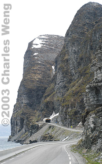
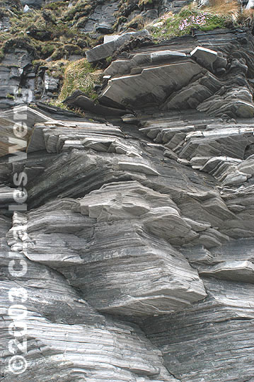
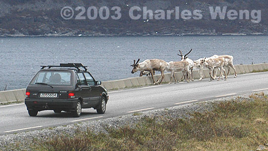 The Road to the North Cape -- The final stretch of the E69 towards Nordkapp, along the eastern shore of the Porsanger Peninsula, is one of the most bewildering drives even by Norwegian standards. The road itself is easy to negotiate, unlike the hairpin switchbacks of the Trollstigen in Rřmsdal. What boggles the mind is the Norwegian imperative to establish a fully land-bound route to Europe's northernmost point, culminating in a series of magnificent tunnels completed as recently as 1999. The longest of these is an underwater "chunnel" 6.4 km (4 miles) in length, linking the mainland to Magerřya island. The cost of this grand gesture must be staggering. To this day and into the foreseeable future, motorists pay Kr 180 (around $20 US) in each direction, entering and leaving Magerřya, which has only about 40 km of sealed roads between Nordkapp and its nearby seaside communities. This does not include the toll of entering Nordkapp itself, but early arrivals can skip it by parking outside the toll gate. Along the E69, constant sights include the stacks of layered slate that constitute this chunk of continental extremity, as well as the roaming reindeer that wear a coat of white fur during the winter. These photos are taken with the Nikon D100 digital SLR with the Nikon 20mm f/2.8 D lens. |
| Previous Page: Alta Museum, Norway | |
| Next Page: Kamřyvćr, Norway |